
LiDAR is a sensor that uses laser beams to calculate distances and speed of objects and create detailed 3D maps and models.
Post about laser operationclick here
Operation principle
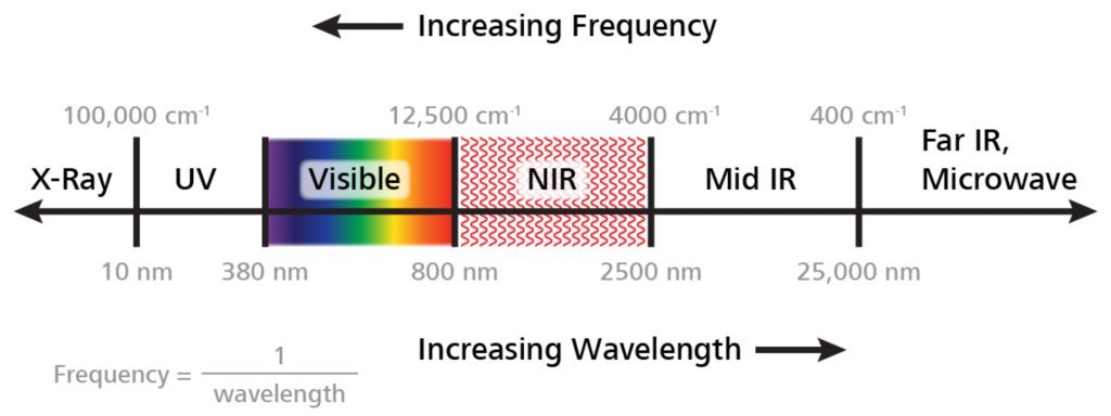
LiDAR is the abbreviation of Light Detection And Ranging. Works similarly to the radar. The sensor sends laser pulses on near infrared (NIR) frequency, objects reflect the pulses and they go back to the sensor.
The time light takes from emission to the sensor is measured and distance is calculated by a processor. To calculate distance:
object distance=(light speed * measured time)/2
Other important components of LiDAR are the inertial measurement unit (IMU), to obtain precise measures of sensor’s orientation and inclination, and GPS, to obtain the object’s coordinates.
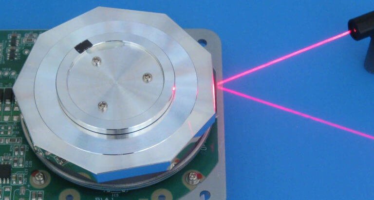
Laser scanner
It emits multiple laser pulses per second in many directions to make a three-dimensional sweep in an environment. The sweep mechanism can be:
- Mobile mirrors or prisms, controlled by electric motors or servomotors.
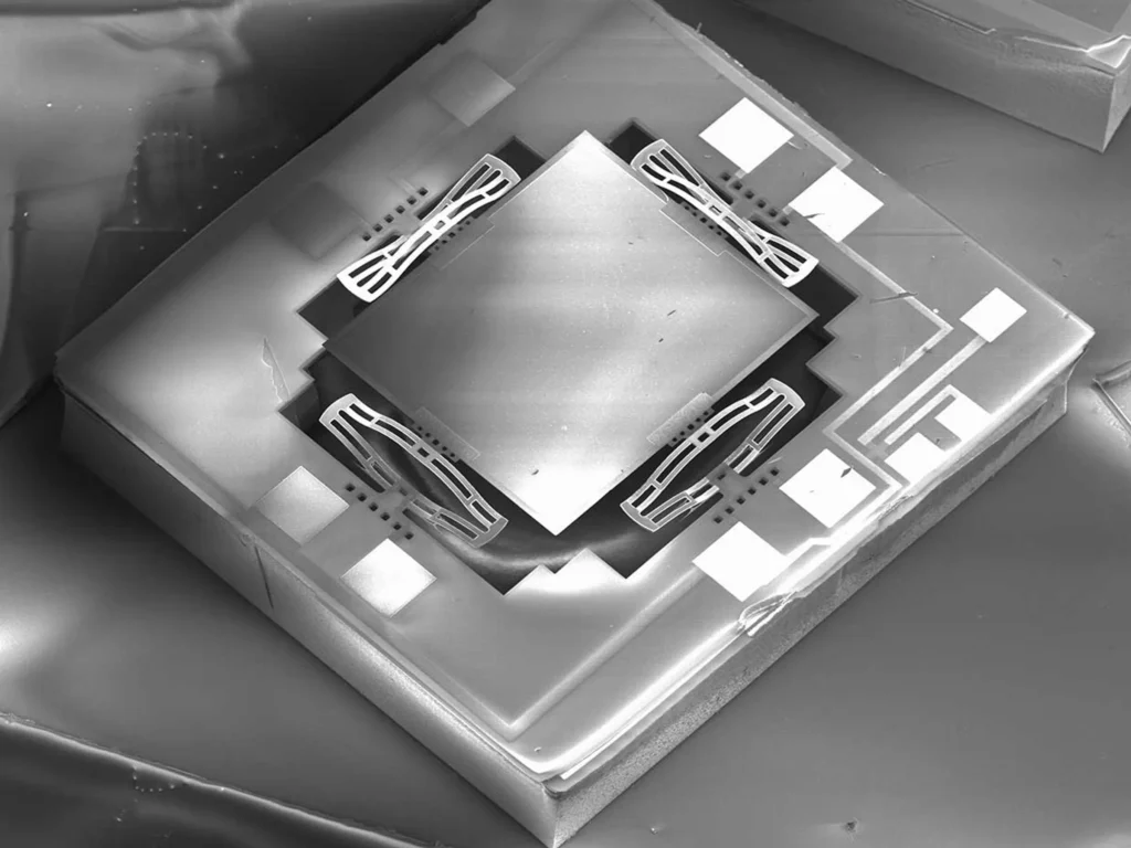
- Micro Electrical-Mechanical Systems (MEMS) with oscillating micromirrors. Serves for applications that require low weight, consumption and size.
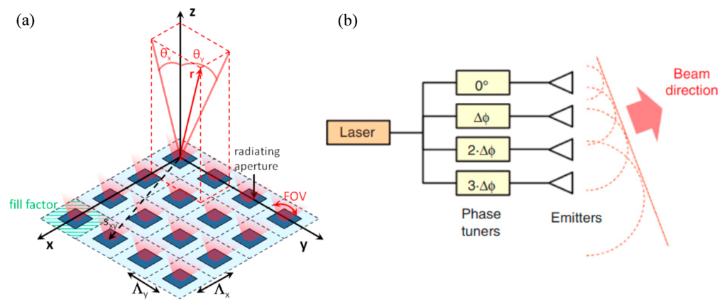
- Optical phase array (OPA), which consists of an array of photonic nanoantennas receiving light from a single laser source, whose light passes through a beam splitter. Each nanoantenna is connected to a phase tuner, whose control is made electronically. The beam direction is controlled by adjusting phase tuners, because the lights emitted by nanoantennas make constructive and destructive interferences.
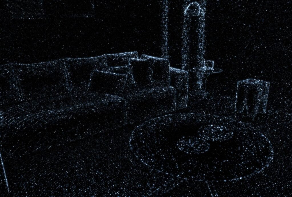
LiDAR emits a great quantity of light pulses per second, creating a point cloud in three dimensions.
Photodetectors for LiDAR
The reflected light is detected by photodiodes. Currently, LiDAR sensors use two types of photodiodes.
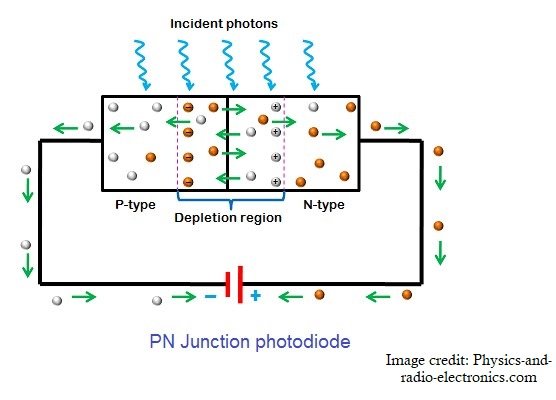
For better understanding, it’s necessary to know about diode operation. The link to the post about how this component works is below.
PIN photodiode
In addition to P and N layers, there’s a third intrinsic layer I, which is bigger than the other two.
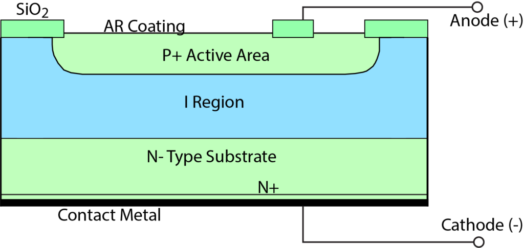
On reverse polarization, the photodiode depletion region obtains the same size of I region. When an incident photon (light particle) is absorbed by the material in I region, an electron receives enough energy and an electron-hole pair appears. The electron moves due to the electric field in depleted region, producing a current. As the number of photons is increased, the number of electron-hole pairs will increase; therefore, electric current will be higher.
Avalanche photodiode (APD)
This type is very sensitive and has 4 layers.
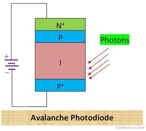
This photodetector uses the impact ionization phenomenon to increase gain and amplify current. When an electron acquires energy from an absorbed photon, it receives enough energy to collide with atoms on p and n+ layers, liberating more electrons, forming a chain reaction.
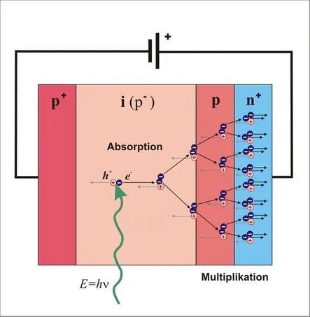
This component requires a high reverse voltage, above 100 V, and the construction is more complex.
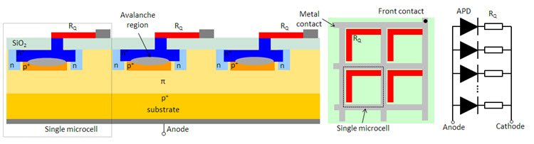
Silicon photomultiplier (SiPMs)
It’s an array of avalanche photodiodes, each forming a pixel or microcell. Each pixel can detect a single photon.
Processing
After data is collected, it needs to be processed to produce accurate models of objects and environments. First, the data must pass through a filter to remove noise and errors, then, they are classified to build models.
Other types of LiDAR
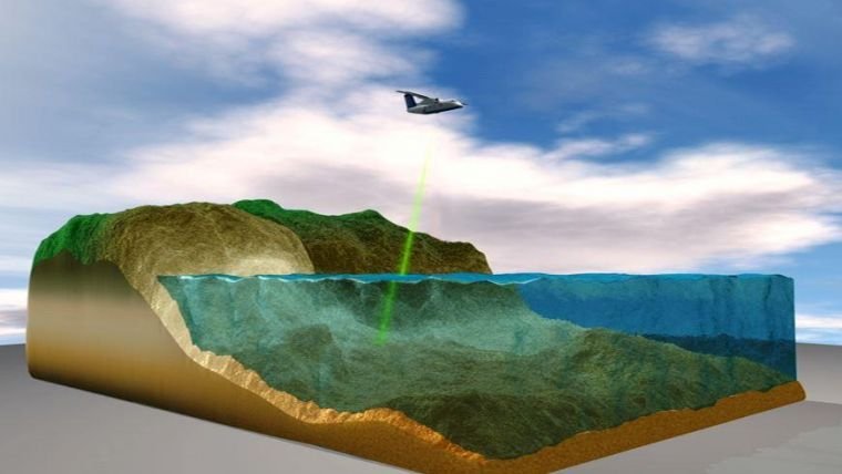
Bathymetric LiDAR uses a green laser to penetrate on water and obtain digital elevation models of coastal seabed, depth of rivers, lakes and reservoirs.
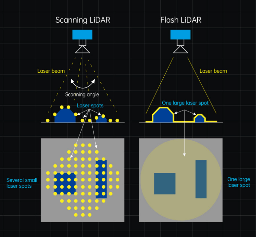
In contrast with the cloud point generator sensor, the flash LiDAR system illuminates an area with a single laser beam, eliminating the scanner mechanism.
The FMCW LiDAR measures distance and speed with frequency difference between the transmitted and reflected beams. With this technology, data processing is very different.
Some LiDAR applications
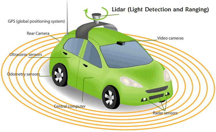
- Mapping with LiDAR will help autonomous vehicles navigate through the environment.
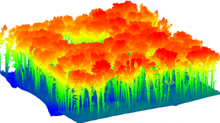
- Environmental monitoring, to evaluate environmental impacts and disasters. LiDAR also allows to observe height and density of vegetation.
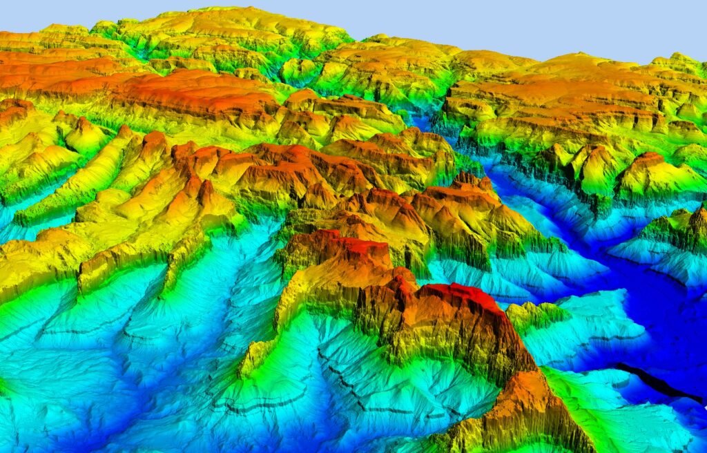
- Topography: this technology produces detailed maps in three dimensions and with a resolution and precision better than photogrammetry, although with elevated cost.
- In archeology, it’s a non-invasive method to search for artifacts and traces.
- Some cellphones have LiDAR scanners.